Pages

Showing posts with label 12hikes. Show all posts

Thursday, December 22, 2016

12 hikes :: 2016! :: o'melveny park

its been while since I posted a new hike - but this was a good one - and worth remembering. friends introduced us to O'Melveny Bee Canyon Trail today.


O'Melveney Park

O'Melveney Park

O'Melveny Bee Canyon Trail
O'Melveny Park
17300 Sesnon Boulevard
Granada Hills, CA 91344
Neighborhood: Granada Hills

Proximity: 13 miles from our home
Hike length: 4.0 miles roundtrip
Bonus features: Beautiful views of the SFV. Dog friendly. Free parking in lot.
Tips: Hard incline (1000 ft elevation gain) on foot path - with some scrambling, so good shoes a must. (Fire road alternative for more gradual incline.)

Thursday, November 06, 2014

looking for fall

we thought fall had arrived. but then it snuck away.

in any case, we know it can't be far away, and i'm looking forward to the thanksgiving week and trying out some new hiking spots.

LA County Department of Parks & Recreation has just launched a beautiful new trails website, here. i love that you can search by zip code. (committing it to memory by posting it here!)

los pinetos trail is at the top of my list.

and of course some old favorites...

12 hikes
last october at malibu creek state park


Monday, March 31, 2014

12 hikes :: march :: calabasas peak

i wasn't prepared to go on a hike today. there were a million things to do at home. but when i got the invitation - and i realized it was the last day of march - i decided it would do us all a bit of good.

i took so many pictures. the sky was a perfect blue, and the interior canyons of the mountains were so much greener than i expected. alas, on our descent i finally noticed the message on my screen "NO CARD". damn. luckily i'd captured a few with my phone. we will be back to take more another day...

12hikes

12hikes

12hikes

12hikes

12hikes

Calabasas Peak from Stunt Road
1699 Stunt Road
Calabasas Highlands, CA 91302
Neighborhood: Santa Monica Mountains

Proximity: 11.6 miles from our home
Hike length: 3.6 miles roundtrip
Bonus features: Beautiful views of Cold Creek Canyon and Red Rock Canyon Park, in the interior of the Santa Monica Mountains. Spectacular rock formations to admire and scramble up. Cool ocean breezes! Dog friendly. Free parking along Stunt Road.
Tips: Moderate incline (1000 ft elevation gain) on well-maintained fire road, so good shoes a must. No shady spots. Park in the cleared area to the side off Stunt Road and cross over through the white gate to the fire road (Calabasas Peak Motorway).

* * * * *

K:

E:

Monday, February 17, 2014

12 hikes :: february :: stoney point park

december we hiked on the island.

january, we revisited a favorite spot.

now back to the task at hand...

12hikes

12hikes

12hikes

12hikes


Stoney Point Park
Topanga Canyon Boulevard & the 118 Freeway
Los Angeles, CA 91311
Neighborhood: Chatsworth

Proximity: 8.5 miles from our home
Hike length: about 1.5 miles
Bonus features: Really a spot for climbing more than hiking. Amazing natural rock formations and giant boulders. Fun look at Stoney Point as captured in old films.
Tips: We parked on Topanga - but it was very busy so beware. An alternate would be to park on Chatsworth and follow the bridal trail to the park. We brought a picnic lunch - but there really wasn't a spot to eat - and it was a pain carrying the backpack and trying to climb. Next time we will start earlier and have lunch after. This is a busy spot for climbers. so lots to watch as well as some fun scrambling up the mountain.

* * * * *

K: I'll give it a 9/10. The climbing was amazing. We found bones and could see the whole area. It was so so so so... so FUN!!!!!!!!! The only reason I gave the hike at Stoney Point a 9/10 instead of a 10/10 was that there was not a creek or stream or river. That would have been a lot more fun.

E: 7/10. I liked climbing where I could. I wish we could have climbed more.


thinking of my dad today. what better way to celebrate his memory, than being outdoors. he would have loved this. loved his granddaughters and their sense of adventure. loved the feel of being in "the old west". loved that it was 78 degrees F in February.

Sunday, November 17, 2013

12 hikes :: november :: san vicente mountain park

12 hikes

12 hikes

12 hikes

12 hikes

For National "Take A Hike" Day we headed off, close to home, for a hike that wasn't so much about communing with nature, as connecting to some local history. "[F]rom 1956-1968, San Vicente Mountain was one of sixteen Los Angeles area Nike-Ajax supersonic anti-aircraft missile launch sites. During the Cold War, Nike sites were located in defensive rings surrounding key urban and industrial areas throughout the United States. This site contained ground-based radar and computer systems designed to detect and track hostile aircraft, and to guide the anti-aircraft missiles that would be launched from nearby Sepulveda Basin to their targets." Along with this bit of cold-war nostalgia, the area offers spectacular 360 views of downtown, the SFV, and all the way to the Pacific.

12 hikes

12 hikes

12 hikes

12 hikes

12 hikes

12 hikes

12 hikes

San Vicente Mountain Park
17500 Mulholland Drive
Los Angeles, CA 90049
Neighborhood: Encino

Proximity: 8 miles
Hike length: about 2.5 miles
Bonus features: Nike site
Tips: Definitely not a destination that feels like an escape from the city, but a good destination for quick urban hike. The kids were fascinated by the old infrastructure. While the weather was warm and sunny at home, by the time we reached the top of the mountain it was quite chilly. Bring change for the telescope!

* * * * *

K: 10/10. I liked the tower. We could see the whole valley from there.

E: 9/10. It was a lot of fun to climb up that tower ;)

Wednesday, October 30, 2013

12 hikes :: october :: malibu creek state park

before the month is over...

i needed some fresh air sunday (too much desk work this week had found its way into the weekend.) and the girls were sure to benefit from it too. so pleased to get the call from my dear friend to hit the road and take in one of his favorite local hikes... (i can't believe we hadn't been before.)

malibu creek state park is 7000 acres of spectacular scenery just a few miles from home. there's the creek, plenty of beautiful old oaks, a swimming hole, and lovely canyon vistas. well-known and visited for the prominent role it has played in many movies, the park also features a wonderful hands on nature center where you can explore the local flora and fauna up close. we made it close - but not quite - to the swimming hole. we will definitely be back.

12 hikes

12 hikes

12 hikes

12 hikes

12 hikes

12 hikes

Malibu Creek State Park
1925 Las Virgenes Road
Calabasas, CA 91302
Neighborhood: Calabasas

Proximity: 13 miles
Hike length: about 3 miles
Bonus features: nature center, M.A.S.H. set, swimming hole
Tips: While the weather was perfect, I am still glad we brought hats and plenty of water. No dogs allowed. Lots of horses, cyclists, and hikers. Nature Center open noon to 4:00 Saturdays and Sundays. Not a place to get away from people, per se, but a great spot to reconnect with nature.

* * * * *

K: The hike was amazing. 10/10. I loved climbing on the trees and visiting the Nature Center. It was amazing to see how many movies were made in the area.

E: Well, IDK. That's all then. 8/10.

Thursday, September 05, 2013

12 hikes :: september :: Wildwood Regional Park

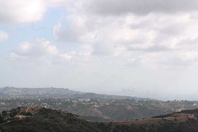
the realization was made in May, that the San Fernando Valley is just not conducive to hiking in the summer. the average daily temp May through October is 90 degrees. (and I'd hasten to say that's conservative.) and quite frankly - in these temps - we would much rather hang out at the beach.

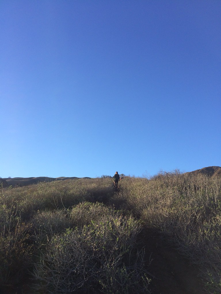
so there we are. the 12hikes project took an unexpected hiatus. and yet - on this day (one of the hottest we've had this summer; reading 105 F when we returned home) - we decided to forgo the beach (expecting crowds) for a hike. a nice way to start a new year we thought. and we weren't disappointed.

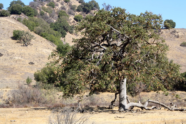
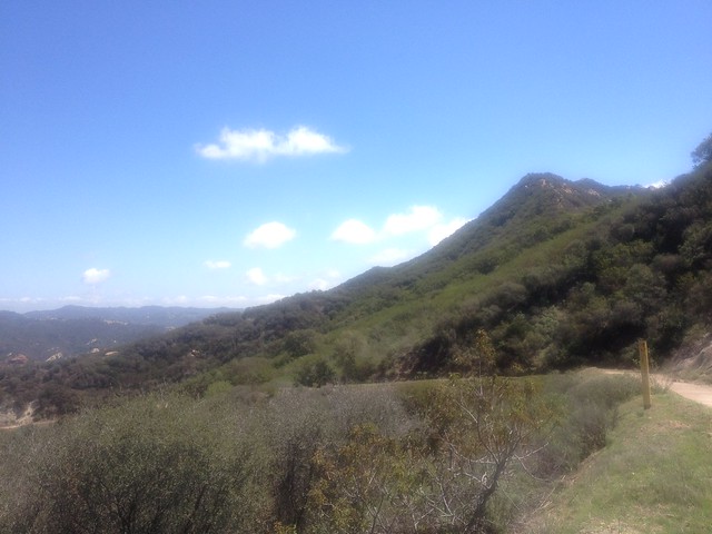
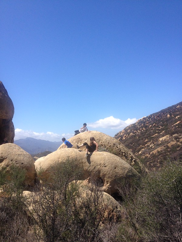
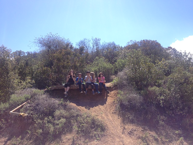
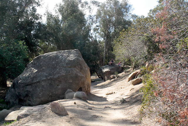
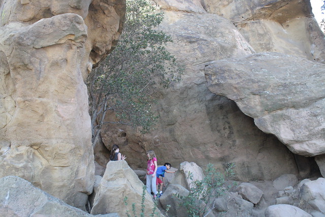
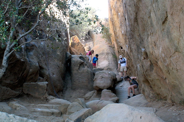
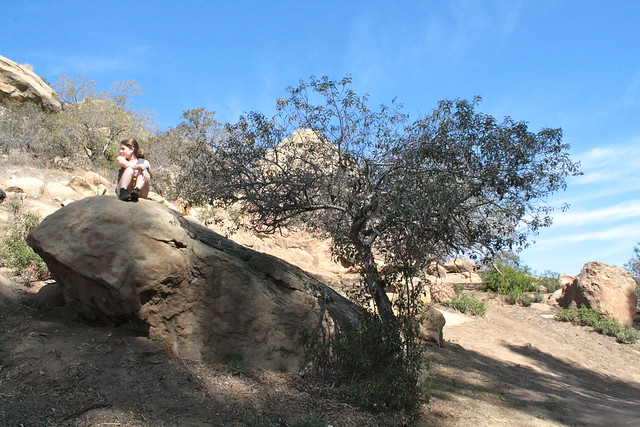
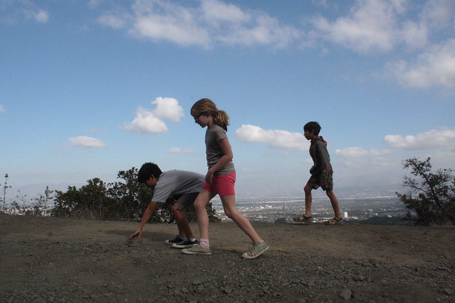
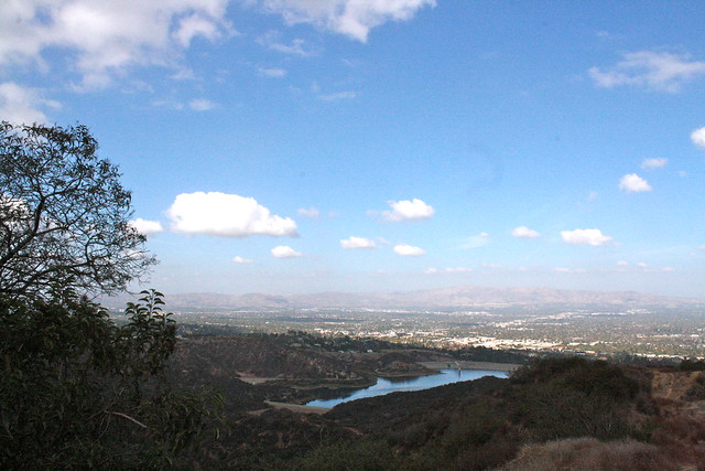
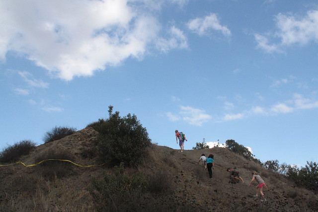
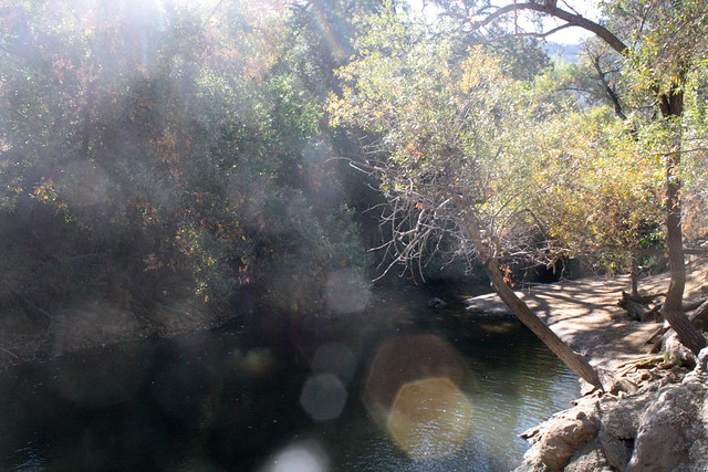
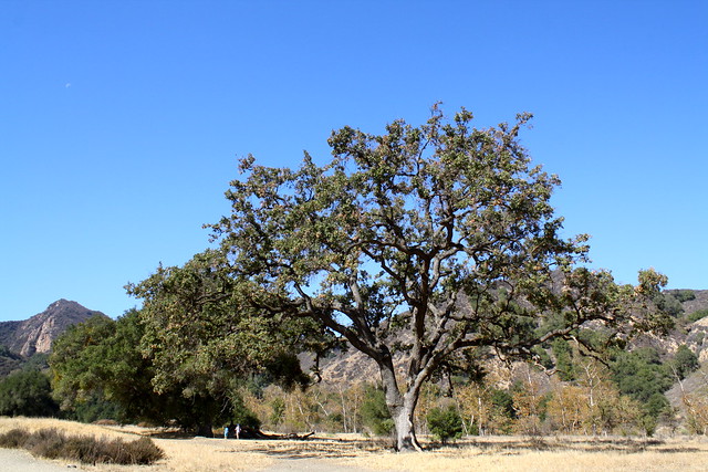
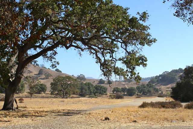
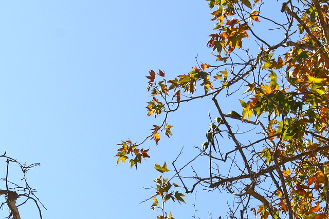
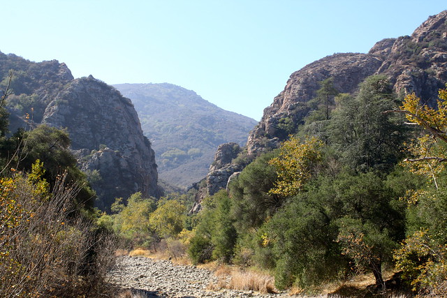
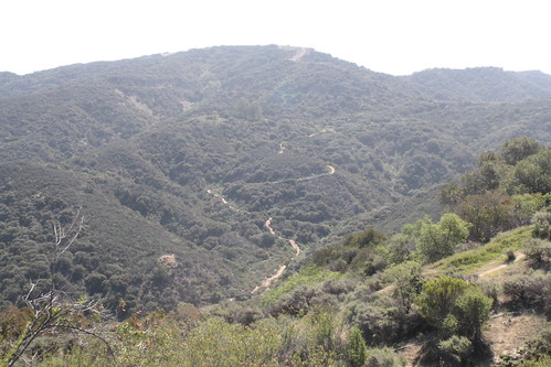
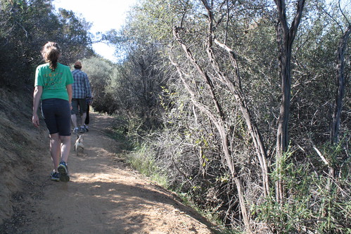
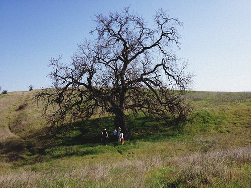
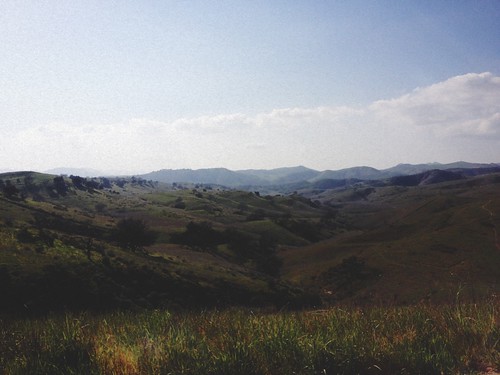
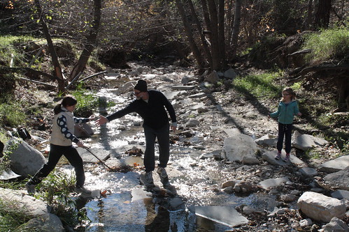
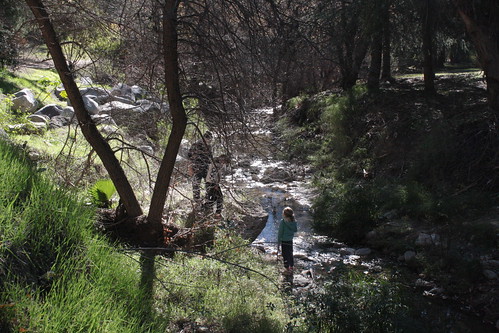
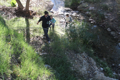
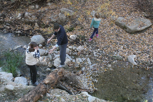
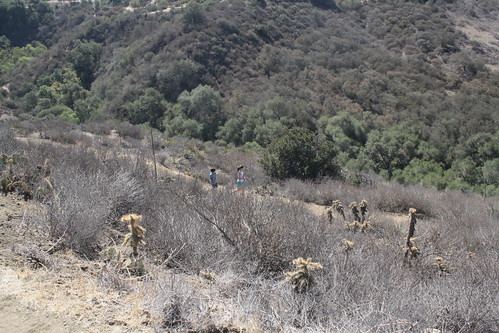
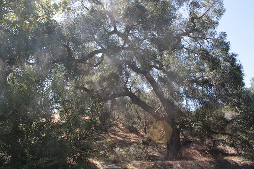
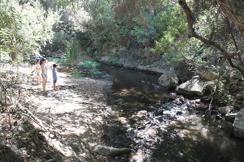
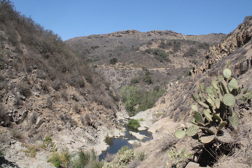
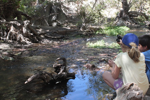
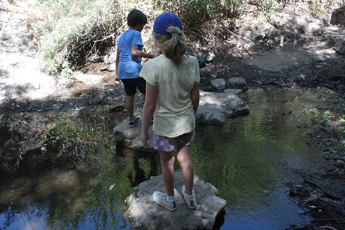
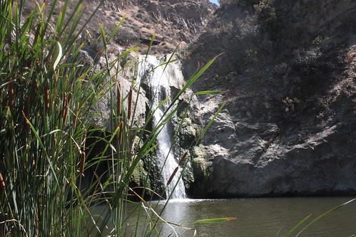
this spot has been on my list for a long time. in fact i have a note on it taped to the inside of our pantry cupboard. there's just something about water (ocean, rivers, lakes and waterfalls!) that my kids are fascinated by. this spot held three out of the four - and even though I am sure the temperature there was hovering in the high 90s - they didn't complain (ok maybe a tiny bit right at the end) and extolled the greatness of this hike all the way home (slurpees in hand might have aided in this enthusiasm!). it was the majestic oaks and sycamores and native plants (great show of chalk dudleyas) that once again won my heart. and i'll admit it was quite a kick to find a local waterfall! (like the previous hike to the open space preserve, this one deserves another visit in another season. wildflowers? fall foliage?)

we read that the chumash originally settled in this area over 8000 years ago (!) and that parts of Spartacus (and other movies and television shows) were filmed here.

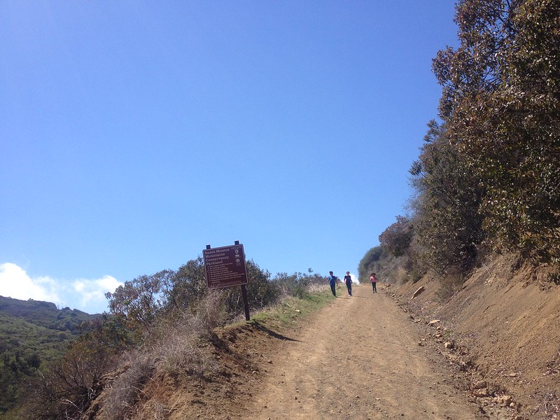
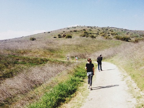
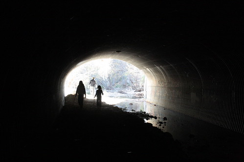
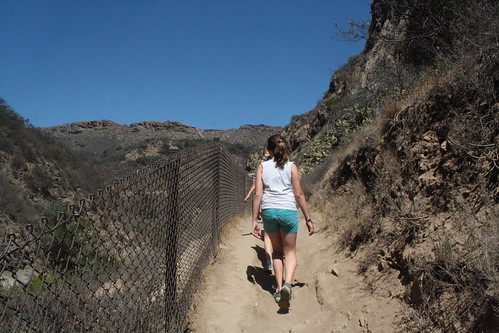
we did the "easy" Moonridge Trail, Paradise Falls, Indian Creek Loop. About 3 miles with a 500 foot elevation change. we will do it again - and explore the other paths soon!

12hikes

12hikes

12hikes

12hikes

12hikes

12hikes

12hikes

12hikes

12hikes

Wildwood Regional Park
928W. Avenida de los Arboles
Thousand Oaks, CA 91360
Neighborhood: Thousand Oaks
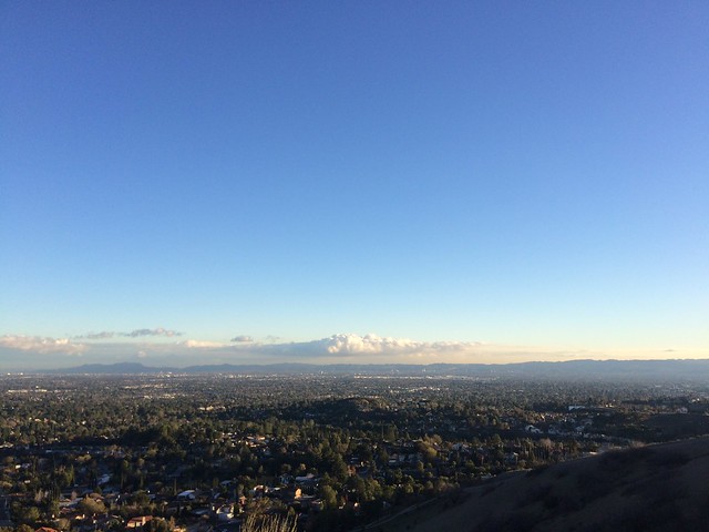
Proximity: 25 miles
Hike length: about 3 miles
Bonus features: creek, waterfall, lovely picnic spots
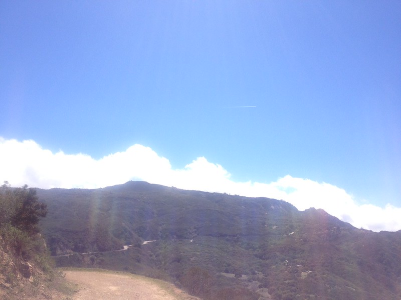
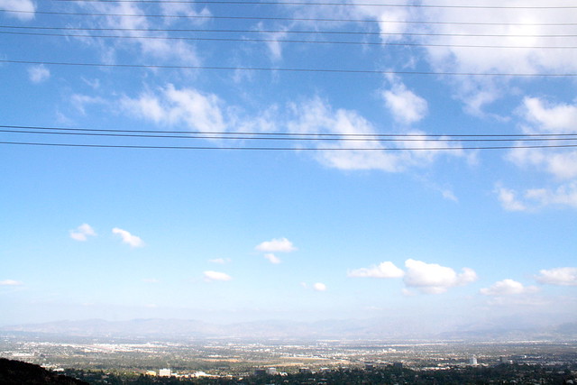
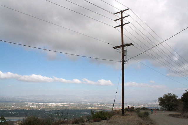
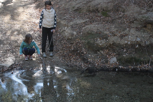
Tips: Today... HOT. There are drinking fountains at a couple of spots (Paradise Falls for one) but I was glad we brought lots of H2O. And glad we had a substantial snack with us that we enjoyed at a table by Indian Creek, in an oak grove (lovely!). We were there for almost 3 hours. I wouldn't really suggest September for this spot. I think late fall / winter / early spring would be much more rewarding as far as landscape. Things were very dry and aside from the trees and cacti, dormant.

* * * * *

K: On a scale of 1 to 10... 9 3/4! It was really pretty and had a nice waterfall. But the bad thing was it was really hot. I'd like to go back on a colder day. Not too cold though.

E: i say that on scale of 1-10 it is a 7 because we were not allowed to swim and it was extremely hot.i would go back when it's not so hot.

Tuesday, April 30, 2013

12 hikes :: april :: Pierce College

popping back in to report on our hike... which almost escaped us once again!

a little bit of a cheat (maybe?) on this one. we hiked over to Pierce College today for their Annual Farm Walk. we are so lucky to have this campus nearby, with its great recreational facilities, its agricultural center, and its abundant wide-open spaces. while the space has been reduced in recent years, it still is a prize to have within walking distance of our home.

farmwalk
farmwalk

farmwalk

Pierce College
6201 Winnetka Ave
Los Angeles, 91356
Neighborhood: Woodland Hills

Proximity: 0 miles (we started from our front door!)
Hike length: 3 1/2 miles : from our front door to the gate to the Ag center is about 1 1/3 miles plus hiking around the Ag center...and home again!
Bonus features: chickens, and cows, and goats! oh my! (plus sheep shearing, horse shows, live music, and much more)
Tips: It is always hot for Farm Walk (bring water!). The rest of the year you can't explore the farm as much, but there are great trails through the campus - all pretty easy.

* * * * *
reviews to follow... must beat mayday!

Friday, March 29, 2013

12 hikes :: march :: caballero canyon

this one was a two-fer for march...

i did the 4 mile loop with my friend earlier in the month (great workout) - and returned with the family for a quick saturday morning hike (only 1 mile) just up the trail along the fireroad and up along mulholland drive.

12 hikes
view of the longer loop from reseda


12 hikes

Caballero Canyon (Topanga State Park)
top of Reseda Boulevard
Los Angeles, CA 91356
Neighborhood: Tarzana

Proximity: 5 miles from our home
Hike length: various trails : i love the 4.2 mile loop for a workout and the shorter trails with the kids
Bonus features: beautiful chaparral with seemingly old manzanitas and wildflowers in the spring. great views of the ocean and valley. shorter trails dog friendly (on leash). lizards, rattlesnakes and coyotes have been spotted.
Tips: we parked for free on Reseda. (there is a propensity for car break-ins on this very popular hiking spot so windows up and doors locked.) bring lots of water. the longer hike takes almost 2 hours and the the shorter allow for at least 45 minutes.

* * * * *

E: I'd say 7 out of 10. It was a really good hike. I didn't really want to go at first. I felt lazy today. But it was pretty on the path we went on so I'm glad we went.

K: 7 too. This hike was more fun than I thought. I thought it would be very boring but it was better than I expected.

D: it had the potential of being a 10, but its a hot hill you want to start early in the morning. with what we actually did, it was good for a leg stretch.

Monday, February 18, 2013

12 hikes :: february :: upper los virgenes open space preserve

it is a beautiful presidents' day weekend. d had to work today - but the girls and i were off, and so were our neighbors, so we decided we better head out for a hike. we've been so under the weather, i knew the fresh air and sun on our faces would do us a world of good.

located on 3000 acres in the simi hills, this beautiful open space preserve was originally part of the ahmanson ranch. a decade or so ago, after much discussion, it was sold to the santa monica mountains conservancy for its importance as an ecoloogical link and wildlife corridor between the santa monica mountains and those to the north. we are so lucky to have it. it is spectacular. rolling hills studded with valley oaks and sycamore lined canyon bottoms. you really do feel like you are miles and miles away.

12 hikes

12 hikes

12 hikes

Upper Los Virgenes Open Space Preserve (formerly Ahmanson Ranch)
western end of Victory Boulevard
Los Angeles, CA 91307
Neighborhood: West Hills / Calabasas

Proximity: 6 miles from our home
Hike length: various trails : we did a perfect 2.3 mile loop
Bonus features: beautiful old oaks close enough to hug and though we didn't find them, there are supposed to be caves to explore (next time). the creek was (surprisingly) dry. vistas that conjured up what settlers must have seen when they arrived in socal. dog friendly (on leash of course).
Tips: we parked on Victory and hiked up to the trailhead so we wouldn't have to pay for parking ($3). it was warmer than i thought (though only around 70 the sun was intense and there isn't much shade at all.) i was glad we wore layers, brought lots of water and a healthy snack. we were there around 1 1/2 hours.

* * * * *

E: 7. It was ok. I like it better when there is a river nearby to explore. It was fun though.

K: 8. I liked that our friends joined us. I liked that we did our own thing. We went our own way down the hill and then met you.

Sunday, January 13, 2013

12 hikes :: january :: limekiln canyon

as our cookie adventure winds down we wondered what we should pursue for 2013. we came up with trying out new hiking trails. one a month. or hopefully more. (d suggested we should have been doing this alongside our cookie consumption - but better late than never.)

we have been discussing criteria: proximity to home; length of trails etc. but haven't nailed them down yet.

waking up to a bright and sunny (albeit chilly) morning we decided to head out to a trail I've known about for years - but never visited: Limekiln Canyon

12hikes

12hikes

12hikes

12hikes

12hikes

12hikes

12hikes

Limekiln Canyon
Chatsworth St & Tampa Ave
Los Angeles, CA 91326
Neighborhood: Chatsworth/Porter Ranch

Proximity: 8 miles from our home
Hike length: various trails from .6 miles to 2.8 miles
Bonus features: water - Limekiln Canyon creek runs alongside the trail
Tips: we parked on Chatsworth and hiked up to Corbin then over the 118 freeway. coming back we went down and under the freeway. next time we will park closer to the trailhead on Rinaldi. the girls whined the first 5 minutes or so - but once they discovered the creek they were in heaven. it would be a great place to pack in a lunch. (we thought we'd be there for an hour but ended up there for almost two.)

* * * * *

K: I would say the hike is an 8 1/2. It was very fun. We did a lot of jumping on the rocks but the only problem was we needed more fun. More jumping in the creek and jumping on rocks.

E: 7 1/2 because we didn't explore as much as I wanted to and you didn't pack a lunch. Pretty fun though.

D: This little hike was great. Very low on expectations and very high on the return. It had everything you would want. Beauty, quiet, watery creek, smooth paths and a cool tunnel.

It was just one of those perfect accidents. We park in the wrong place but it adds a super mystery tunnel. Just when we walked to the end, there were some friends that just happen to be at the top. The creek had the kids jumping across rocks and building dams. It was low impact and Moxie friendly. Gonna be hard to follow this one. Can't wait. And I can see us coming back here again!!